
Todorka peak (2.745 m) is a part of Pirin mountain range, located in southwestern Bulgaria. On the eastern slope of Todorka there are trails of Bansko ski resort. While on the western slope, at an altitude of 2,536 m, there are two lakes, called by locals «ochite na Todorka», which means «eyes of Todorka». However, there is another funny name, given by russian hikers «kidneys of Todorka». While the official geographical names of these lakes are Gorno and Dolno Todorino. A scenic pathway leads from Vihren hut to Todorka lakes. Route is medium difficulty, suitable even for hiking beginners. The time of round trip is approximately 7 hours.
In total, there are 8 lakes on the way: Окото (Okoto, «Eye»), Рибно (Ribno, «Fishy»), Дългото Бандеришко (Dylgoto Banderishko, «Long»), Жабешкото (Zhabeshkoto, «Froggy»), Горно и Долно Василашко (Gorno and Dolno Vasilashko, «Upper and Lower»), Горно и Долно Тодорино (Gorno and Dolno Todorino, «Upper and Lower»). The trail is clearly visible, especially during the warm season. Route is marked very well, so it is possible to go without guide. However, there are several places, where trail passes over a dangerous cliff.
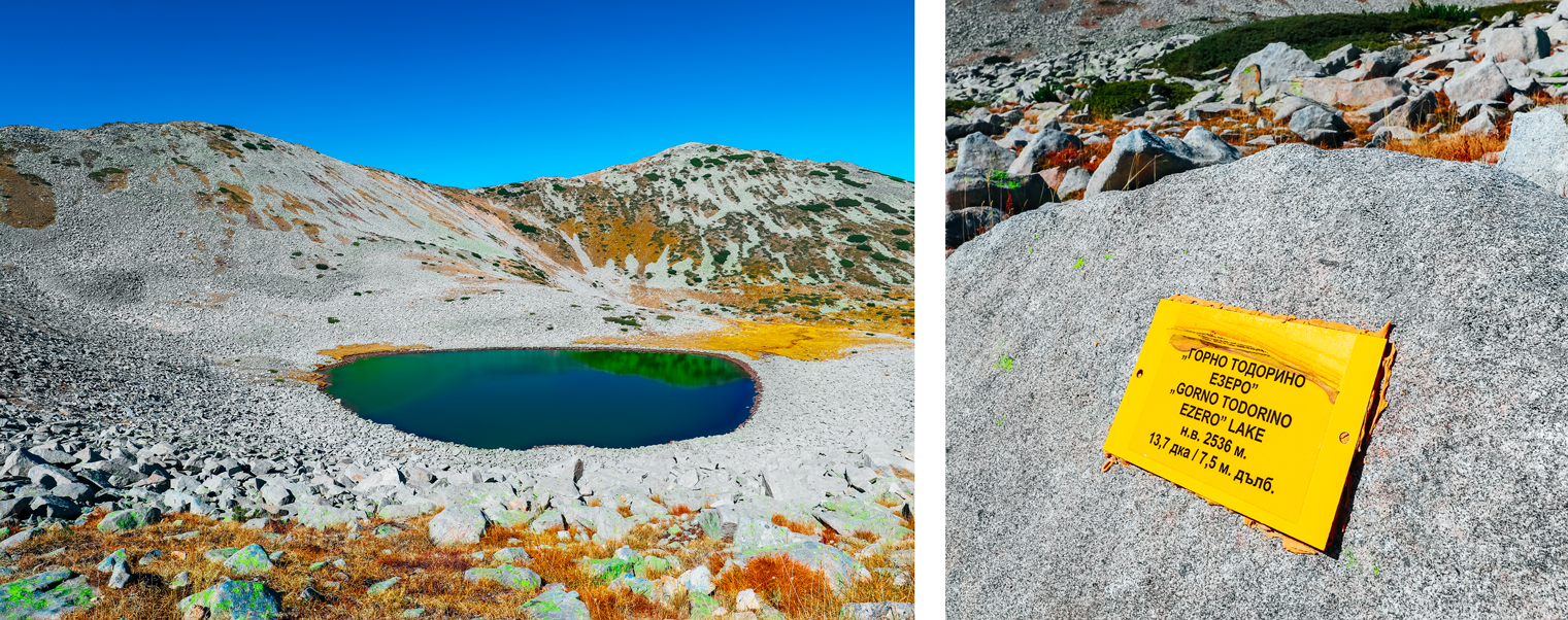
Gorno and Dolno Todorino on the map
Route
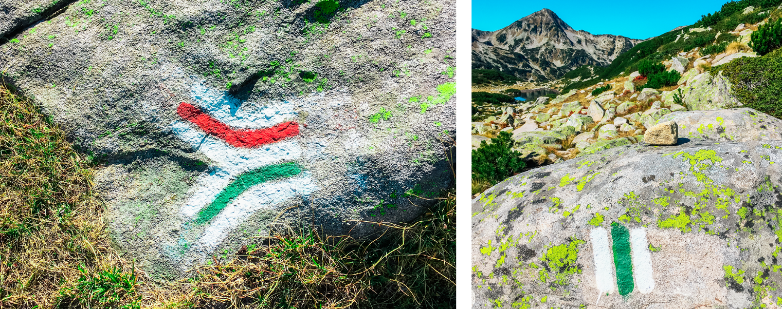
As it was already mentioned, walking path starts from Vihren chalet. Parking is free, however, during the season there are some restrictions, which were listed in the previous article. Guiding marks looks like three stripes «white-green-white». However, from Vihren chalet to Zhabego lake, marks are paired with a second route: two additional stripes above — white and red. There are no sources of running water along the way, but water for the lake is suitable for refreshing.
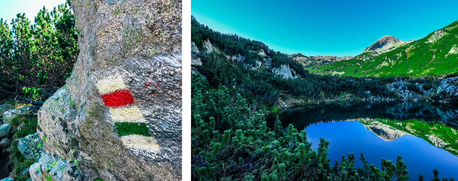
Route marks from Vihren hut
Okoto and Fishy lakes
First lake, Okoto, is just in 20 minutes from Vihren hut. The lake is quite small, but there is enough place to stop for a while and admire the marvellous view: nearest peaks are reflecting in the water. A scenic trail runs right along the shore. Lake Okoto is located at an altitude of 2,026 m.
Next lake on the way is Ribno Banderishko, probably it got this name due to the large amount of fish. The road goes round, but you can turn off the path and enjoy the view. Important to note, that further on the trail, mobile communications and the Internet will be lost. So, only offline navigation apps will be available (we recommend to use maps.me). Lake Ribnoto is located at an altitude of 2,190 m.
View on Zhabeshko and Banderishko lakes from the passage
Zhabeshkoto and Banderishko lakes
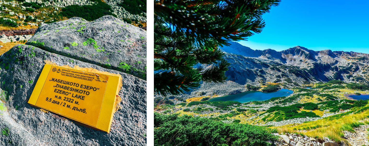
Zhabeshkoto lake is the best place to stop and rest. The rapid passage is ahead, so further climbing uphill will take some strength. Recommended time of the break is 30 min. An altitude of Zhabeshkoto lake is 2,322 m, while the depth is only 2 m. The water is warm and stagnant, so it is possible to hear frog's songs in springtime. Important to know, that near Zhabeshko lake route mark will be changed. It is clearly displayed on the pointing stone. Further way is marked with tree stripes only: «white-green-white».
Dylgoto Banderishko lake is in 100 m from the previous one, which located slightly lower. There is no need to come close because further uphill will open a beautiful panorama on it.
Route marks separation near Zabeshkoto lake
Passage climbing
Zigzag trail leads upward, revealing, meanwhile, a magnificent view of the valley. The very top of the passage opens even more breathtaking panorama on the gorge, Vasilashko lakes, Polezgan and Dzangal peaks. There is a probability to confuse Vasilashko lakes with Todorka's and get upset due to their distant location. Therefore, it's important to remember, that Todorka lakes are not visible from the passage. Also, there is a possibility of losing direction, due to the large number of the trails, leading away from the main route. So, it's important to follow the markup strictly. The best viewing place is indicated with a large triangular rock.
View of the valley from the passage, Vasilashko lakes
Difficult part
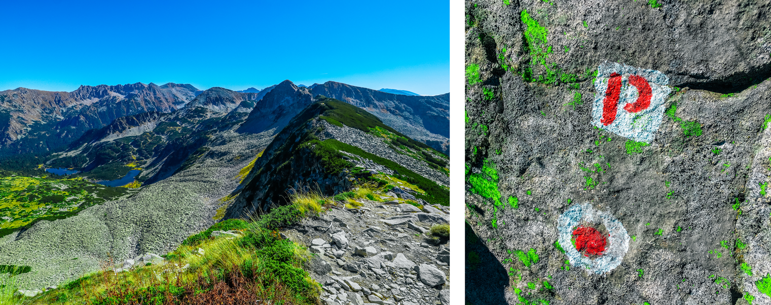
The last part of the route is the most dangerous, as it runs along the cliff. Those, who feel tired after climbing, should enjoy the view a bit longer and have a good rest. Especially dangerous places on the trail are marked with the red letter «P». The path is quite wide, however, people with fear of heights may fill uncomfortable. This part of the way takes about 30 minutes.
Todorka's lakes
The end of the trail overlooks first «Todorka's eye». Lakes are located quite close, but one is hidden behind the small hill. Main route is leading to the soil between lakes, so don't get down across the rocks. Water is quite cold for swimming, but good refreshing feet. It's important to remember, that most of the injuries and falls usually occurring on the way back, so have a good rest before you turn round.
Alien landscape of the western slope of Todorka
What do you'll need:
- Hat.
- Sunglasses.
- Drinking water(1-2 liters). There are no springs on the route.
- Protective sunscreen.You can get sunburn in the mountains all over the year.
- Comfortable sneakers,or hiking shoes. A jacket with a long sleeve in summer. Windproof jacket and sweatpants for autumn and spring.
- Some food.(Fruits and snacks).
- Some «Pirinsko» beer.Mostly for the photoshoot ;)
- First aid kit, walking sticks are up to you.
- Smartphone with offline maps. Will be useful in case losing the way.
Demyanitsa hut
Further route leads to the Demyanitsa hut, through the Dolno Vasilashko lake. Additional journey will takes about 4 hours. So, if you aren't planning to stay the night at Demyanitsa hut, it's better to turn back after Todorka lakes.